EPR3D: Magmatic Plumbing at the Fast-Spreading East Pacific Rise
In collaboration with Lamont-Doherty Earth Observatory of Columbia University and Woods Hole Oceanographic Institution
Funded by the United States National Science Foundation
More than a quarter of a century ago it was demonstrated that mid-crustal magma bodies beneath the fast spreading mid-ocean ridge of the East Pacific Rise (EPR) could be imaged using multichannel seismic (MCS) profiling. This remarkable discovery initiated a period of intensive research that has seen many MCS profiles acquired along, across and adjacent to the EPR ridge axis between 16° N and 20° S. With a single exception, these experiments have aimed for broad coverage of the EPR with 2D seismic profiles, often motivated by the objective of examining the axial magma chamber (AMC) and internal crustal structure in places where the ridge’s morphology, geochemistry, or other features exhibited a range of tectonomagmatic characteristics. As a result, the total seismic reflection coverage of the EPR ridge axis is extensive while sparse. During the same quarter century many areas of the EPR have been examined in detail both directly from submersible dives and sampling programs, as well as indirectly using high-resolution acoustic mapping techniques. A number of areas are now extremely well characterized from the perspective of surface phenomena including faulting, volcanism, and hydrothermal and biological activity. What has emerged are two unique perspectives on fast spreading ridge processes: one based on analysis of detailed observations from relatively small focus areas at the seafloor; the other comprising a highly developed understanding of the broad-scale spatial characteristics of the magmatic system and internal crustal structure of fast spreading ridges. What has not yet emerged is an understanding of how the magmatic system, which is known at large spatial scales (1-100 km), is coupled to volcanic/hydrothermal/ biological systems, which are known at comparatively small spatial scales (0.001- 1.0 km). Nor do we have more than an intuitive appreciation for the relationships between the temporal variations in subsurface magma systems and highly transient phenomena observed at the seafloor like faulting, volcanism and hydrothermal venting.
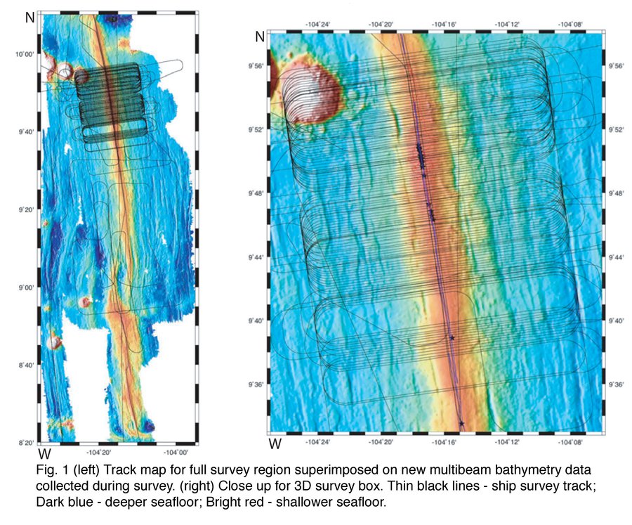
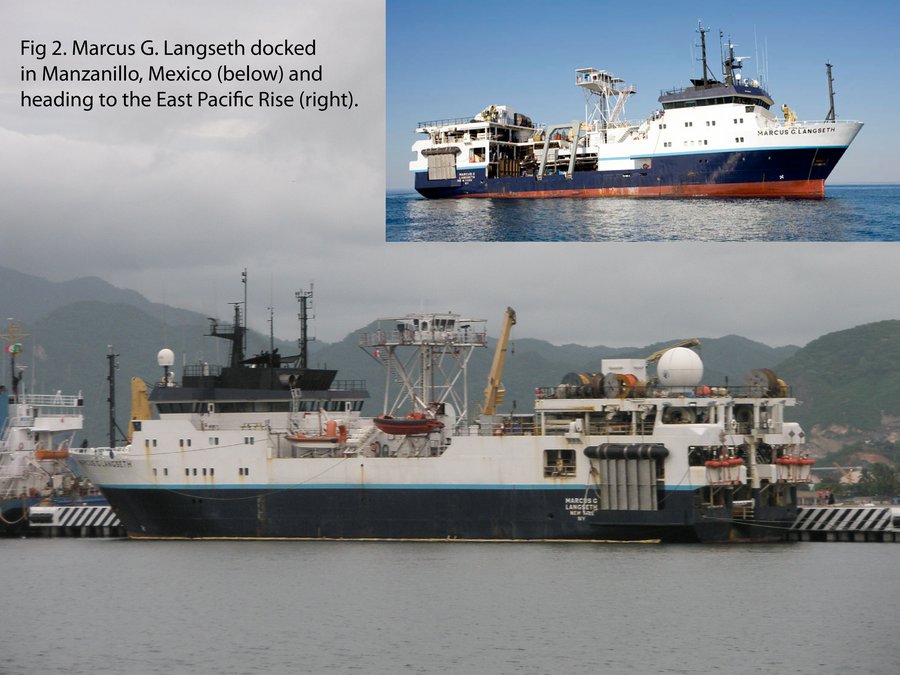
To gain knowledge about these important gaps in our understanding of ridge processes, a group of researchers from Lamont-Doherty Earth Observatory of Columbia University, Woods Hole Oceanographic Institution, and Dalhousie University have carried out a detailed 3D MCS experiment on the EPR at 9° 50’ N (see Fig. 1 for experiment location).This is the first multi-source and multi-streamer 3D seismic reflection experiment carried out using academic resources. The experiment was done aboard the R/V Marcus G. Langseth (see Fig. 2) from June 29 to August 19, 2008 during cruise MGL0812. The targeted area was the RIDGE-2000 Integrated Studies Site at the East Pacific Rise (EPR). This is one of the best studied fast-spreading ridge environments in the world, the place where axial magma chambers (AMC) were first imaged, and the location where two spatially coincident eruptions were documented in the past 20 years. We collected about 1000 square km of 3D MCS data. Our primary 3D survey grid extends from about 9°57′-9°42’N, with a smaller grid just to the south covering approximately from 9°40′-9°37.5’N (see figure). The primary goal of expedition MGL0812 was to use the newly available multi-streamer capability of the R/V Langseth to collect data with which 3D seismic reflection images of the magmatic-hydrothermal system could be created at a resolution, geometric accuracy, and scale comparable to seafloor observations of hydrothermal, biological, and volcanic activity. Seismic reflection ”mapping” at a resolution comparable to the scale of variation of surface phenomenon will allow us investigate the relationships and interactions between sub-surface and surface processes. The 3D volume will also be used to address the structure of the lower crust, the Moho, and the uppermost mantle with unprecedented detail. Furthermore, our 3D seismic study will establish a baseline image of the magma body and upper crust against which changes in geometry and physical properties can be detected in the future using 4D time-lapse seismic imaging.
The quality of information contained in the collected data significantly surpassed our original expectations. The first pass, real time brute stacks generated onboard during the survey suggest major new discoveries, such as images of off-axis crustal magma lenses that would likely have been disregarded as side-scatter events in single pass 2D lines. To extract the maximum possible amount of information from this large dataset we divided the tasks, rather than the data, among the three groups (Dalhousie, LDEO and WHOI). This way we will continue to closely collaborate with our colleagues at Columbia University and Woods Hole Oceanographic Institution on all aspects of the data analysis and interpretation. At Dalhousie University, we are investigating the deeper structures, mostly those found below the AMC. Imaging directly below the AMC is particularly challenging due to seismic energy attenuation and wave scattering, as well as large lateral velocity variations within and in the vicinity of this melt or mush sill. However, the potential “pay-off” is tremendous as imaging lower crustal sills right at the ridge axis is the “holy grail” of the ridge seismic community and the collected data provide the best opportunity yet to succeed in doing so. We have produced the first prestack migrated images of a mid-ocean ridge environment. The first batch of results is already published (Canales et al., 2012, Nat. Geosci.; Carbotte et al., 2013, Nat. Geosci.; Aghaei et al., 2014, Geochem. Geophys. Geosyst.; Xu et al., 2014, J. Geophys. Res.; Han et al., 2014, Ear. Planet. Sci. Lett.; Marjanović et al., 2014, Nat. Geosci.; Marjanović et al., 2015, Geophys. J. Int.). We started the second batch of publications with Aghaei et al., 2017, J. Geophys. Res. Several manuscripts for Science, G-cubed, and J. Geophys. Res. are at various stages of preparation and will be submitted in 2018-2020. The produced 3D image volume contains significant new information and we will continue to mine it until about 2020.