Deployable Equipment
Ocean-Bottom Seismometers
The NFSI operates a pool of state-of-the-art broadband ocean bottom seismometers (OBS). A total of 120 OBS will be available for use in various projects when the facility is at full capacity (expected 2023). This large number of receivers allows for dense data sampling and application of advanced analysis techniques to significantly increase the image and/or velocity model resolution of the subsurface, as well as improve the accuracy of earthquake location and characterization for passive seismic studies. For a brief history of OBS development and use in Canada and globally, please see Nedimović (2019).
The NFSI instruments are Aquarius OBS manufactured by Güralp Systems Ltd. The OBS are able to record for greater than 1 year at a time to enable longer-term earthquake recording. For studies where secondary deployments are needed, the OBS design and our deployment infrastructure allow for quick data download and battery recharge of recovered instruments at sea. The OBS are rated to a maximum water depth of 6000 m and fully operational at angles of +/-90 degrees from vertical.
In order to measure the full wave spectra from local and regional earthquakes, as well as from artificial controlled sources, and much of the wave spectra for teleseismic events, the instruments include broadband 3-component seismometers with flat instrument response between 0.01 and 100 Hz and broadband hydrophones. A large dynamic range (24 bit) and low instrumental noise level allow us to resolve the signal arriving from small earthquakes and artificial sources at larger distances without saturating on the high amplitude signals generated by larger earthquakes or controlled sources at close range. The OBS are equipped with an internal three-axis magnetometer and MEMS accelerometer to record accurate orientation while deployed. Upon recovery, recorded data are offloaded as miniSEED format files.
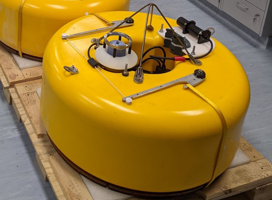
Figure 1. One of NFSI's Aquarius OBS in the lab.
To minimize the cost of field experiments in remote and hostile environments, the NFSI’s OBS are able to be easily and reliably deployed and retrieved from smaller-sized, lower-cost vessels of opportunity which might be available close to the study areas. For deployment, the OBS recording package, enclosed in a pressure case and surrounded by a syntactic foam buoyancy, is attached to a steel anchor so they sink together slowly through the water column and settle upright on the ocean floor.
The OBS are equipped with Sonardyne acoustic modems for remote communication while deployed. Locations of the instruments at the seafloor can be determined using standard acoustic ranging or, where high accuracy is needed, using a GyroUSBL (ultra-short baseline) acoustic transceiver. To recover the instruments, a burn-wire release is triggered acoustically from a nearby vessel causing the instrument to detach from the anchor weight and return to the surface under its own buoyancy provided by the syntactic foam cover. Multiple units in close proximity can be triggered together to minimize total recovery time.
For recovery purposes, the OBS are equipped with satellite and radio beacons manufactured by Xeos Technologies in Dartmouth, NS, as well as a high visibility flag. The beacons activate and begin transmitting on exposure to the air when the instrument surfaces, alerting NFSI staff of both planned and unexpected surfacing. An Apollo Mono beacon provides precise GPS position information world-wide through the Iridium network in near-real-time and is equipped with an LED flasher which activates in low-light conditions. An XMB-11k VHF radio beacon provides accurate directional information in conjunction with an antenna used on deck during recovery operations.
Land-Based Nodal Stations
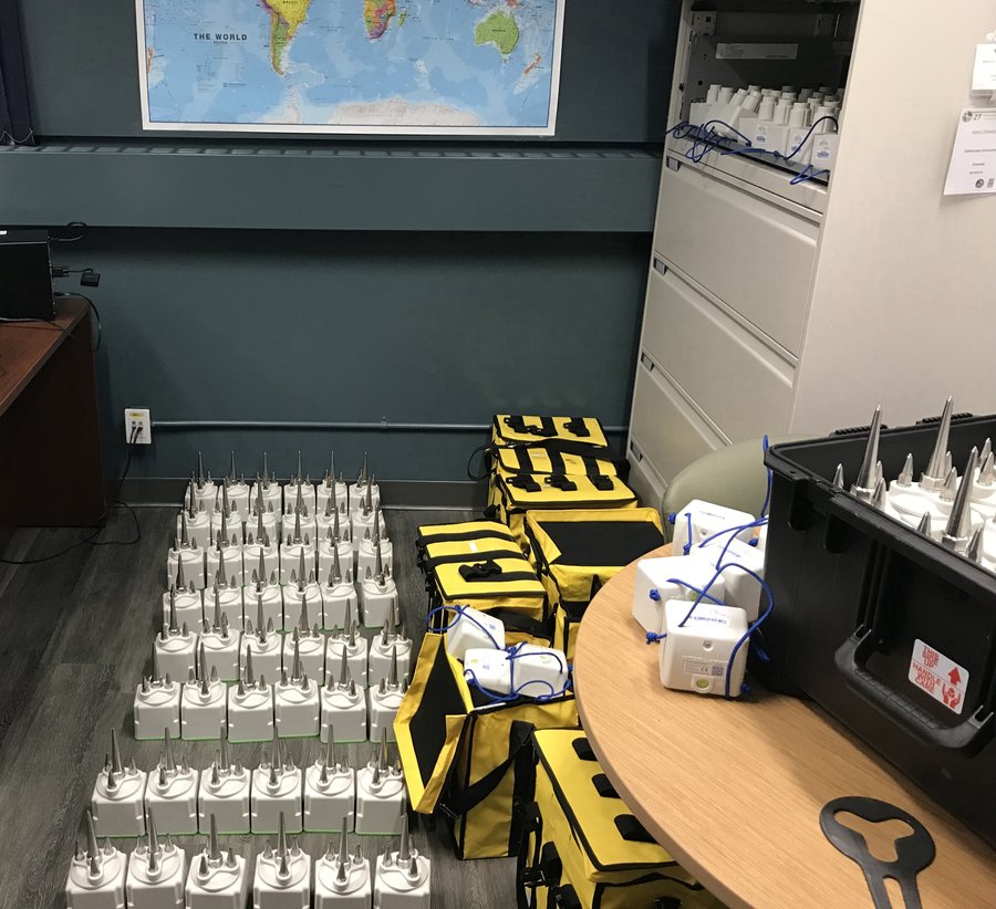
The NFSI houses a pool of 96 SmartSolo IGU-16HR 3C short-period nodal stations owned by Dr. Miao Zhang of Dalhousie University, which are available for use by the broader seismology community.
These sensors are self-contained with a maximum recording length of 30 days at a time, a natural frequency of 5 Hz, and selectable sampling rate between 250-4000 Hz. They are suitable for both passive and active source seismic recording, with an optional segmented recording mode (12 hours on, 12 hours off) for use during active source surveys to double the total deployment length to 60 days. The IGU-16HR is equipped with a spike for coupling to sediments, and is deployed by shallow burial (<10cm). Onboard GPS allows the sensor to obtain an accurate position and discipline the internal clock during deployment. Recorded data is offloaded to SEG-Y format on recovery.
SmartSolo IGU-16HR 3C nodal stations disassembled pre-deployment: spike and battery packs (bottom left), and sensor package (top right).
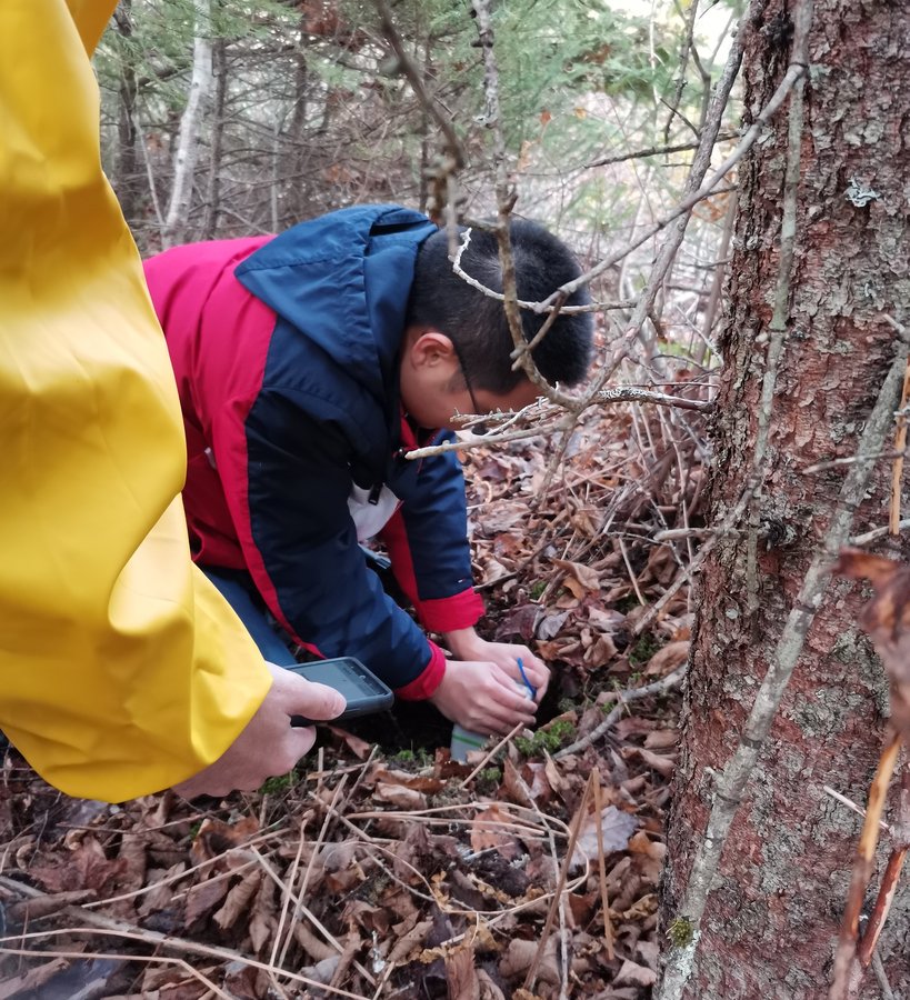
Deploying a SmartSolo IGU-16HR 3C nodal station on the east coast of Nova Scotia.
USBL System
The NFSI owns a Sonardyne Ranger 2 GyroUSBL 7000 system, which is used to obtain highly accurate locations of the OBS at the seafloor. When not in use for NFSI operations, the USBL is available for use by other groups, with support from NFSI technicians. The USBL may be deployed on ships with compatible infrastructure, either via a dedicated pole on the side of the ship or with a through-hull mounting system (e.g., moonpool).
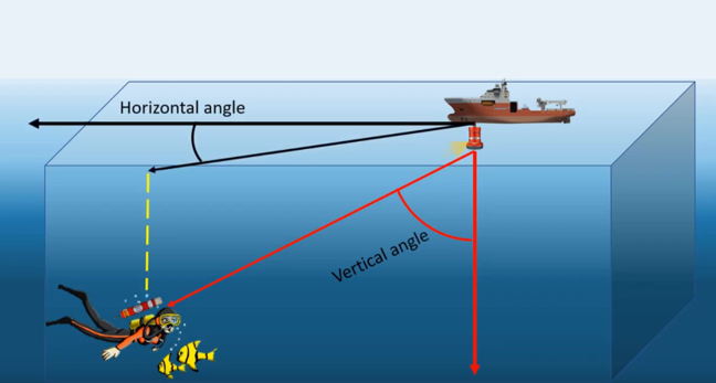
An ultra-short baseline (USBL) positioning system uses an array of closely-spaced acoustic receivers, and obtains a vector measurement of the range to a subsea transponder via the phase difference between the signals recorded across the array. This provides very accurate locations in much less time than traditional positioning with a single surface acoustic modem.
The GyroUSBL includes a built-in Attitude and Heading Reference System (AHRS), used to determine the orientation and movement of the unit during operations. During operation, the GyroUSBL uses input from the ship's GPS antenna to determine its own position and that of any subsea beacons being interrogated in geographical coordinates.
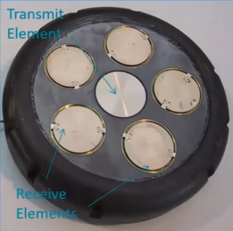
Example of a USBL transceiver array
Vector measurement obtained using a USBL transceiver